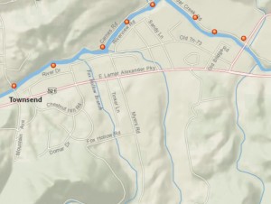
 After years of delay the State Web-master finally fixed the TWRA website. Mainly what I am talking about is the Trout Information/Stockings site. The links have been broken for years. But the good news is now it is up and running. The biggest change was going away from the (pdf.) Stockings site maps to the ArcGIS Online, Cloud-Based Mapping Platform. Which at first I thought was a big mistake until I learn to could change the base maps. When you open up the page you see a Imagery with Labels base map that has a satellite picture with very few labels. At the top left of the page you will see where you can click on the basemap gallery, from there you can chose from nine different basemaps. The National Geographic is the one I use and it has the best roads and streams labels. The old USA Topo show some of the hiking tails. The print button only prints part of the page so you will need to center it to print what you need. So now the (T.N. Stocked Trout maps) link to the lift is now working.
Good fishing <((((<
Joe


